Thursday, June 21, 2007

Grouse Ridge

last weekend I went hiking at grouse ridge with another hiking buddy from the yolohiker club. it's north of HWY20/I-80 in the tahoe national forest. in order to get to the grouse ridge trailhead, you have to follow a dirt road for about 6miles, which took 40mins. this road takes you to the grouse ridge camp ground and access to the trail head from which you can hike to many destinations.


we chose to hike to glacier lake, which involves descending into a valley and then going back up another ridge. this trail was nice and well marked. we met lot's of hikers coming from glacier lake, including a group of search and rescue dog handlers who were practicing in the area. we finally made it to glacier lake, which was a total delight. we stopped for lunch. I decided to hike up to the saddle over the snow fields, which I presume are the left overs from the "glacier" after which the lake was named. the hike up the saddle was streneous and tricky, since the snow/ice fields had pockets near the edges. the view at the saddle was worth the short jaunt. after coming back down, I took a dip in the lake, which was really cold !


there is a nother trail back along sandy ridge, but it wasn't obvious and we asked some of the other people we met for directions. their directions were pretty murky too. after some stumbling, we stumbled on the right trail and headed back out, meeting a boys scout troop and a group of trail horse riders complete with mules to carry gear.

my friend went home, and I stayed in the area planning to do some backpacking on the other trails. our day hike took a little longer then expected, so by the time it got dark I wasn't too far into the next hike. I had intended to hike to a place called baltimore site. after spending the night on an overlook to lake spaulding I hiked some more, but when it was clear that there was not enough time to make it out and back before the end of the day, I turned around and hiked back out.


Monday, May 07, 2007

Long canyon, the hard way....

this weekend I decided to connect two trails that I know about. one trails is the fiske creek trail and the other the long canyon loop trail, but of which can be found on yolohiker.org. if you look at the map, the trails aren't that far apart, aprox. 0.5mi straight line. of course, straight line would mean fighting brush up a steep canyon to get to the saddle of long canyon loop. by car, the trailheads are easily a 2.5-3.0hrs drive apart, since you have to drive out of one valley, drive up another valley, go around lake berryessa and up a lonely back country road. so, I set out to find a route that would connect the two trails.

this is going to be a long hike, and possibly an overnight trip if I didn't get back before sunset. so I decided to take my backpack. one of the goals is to document any routes for others to use, I decided to take my GPS, which I normally don't take. I programmed in one of the critical way points (the saddle) into my GPS, so that I would have a place to navigate to if I get stuck in deep brush.

I started off the hiking up to the fiske creek trail head since the county road is not open yet. then following fiske creek trail until the southern trailhead. of course, once the county road is open, one can just drive to the far trail head. however, this trail is actually very nice and I enjoy hiking it anyway. the southern trail head is on fiske creek road, which connects rayhouse road one the adjacent ridge with the blue ridge. now the fun starts. from the trail head, we can't see the saddle since it's occluded by a hill. but no worries, I had the saddle programmed into the GPS, although it seemed weird that the GPS thought the saddle was farther west then I thought it would be...

well, I walked east on fisk creek rd looking for any path that might go up to the saddle and found one past a small picnic/camp area... following the path it quickly petered out into a washed out ravine. at one time, this could have been a fire break of jeep road, but years of rain had eroded the trail into a ravine which was grown over with brush in places, but it kept going up the hill, towards the west... there were a couple of promising intersections and I could see the saddle once I got high enough. the GPS, was pointing the wrong way... hmm, maybe the map I got the coordinates from was wrong. I followed the path until found sign telling me that I was entering a CA wilderness area and that motorvehicles weren't allowed..., past the sign, I met up with the long canyon loop trail, but about 0.5 miles to the west of where I wanted to be. oh, well.

the long canyon loop trail was nice and I scared up some turkeys and saw what looked like a couple of bears in the valley below, as well as a nice lizard on the trail. since I got a later start then I wanted to, I made it a short loop, instead of the long loop. the trail back to the saddle goes up the long canyon past the spring. somewhere along the way, I realize that I had mad a mistake entering the coordinates from the map onto my GPS... longitudes increase right to left on the map in these parts, and I read it off right to left... so I was off by about one minute (1.2 miles). this time, when I got to the saddle my new coordinates matched up pretty well to real life...

at the saddle I still couldn't see an obvious way down into the canyon or the road, but I found a fire break along the ridge that went off to the east. eventually, the road would intersect with the fire break. at this point I was close to blue ridge and could have returned by ascending up the ridge and then following the blue ridge trail north past lowry and fiske peak. but since it was getting late, I decided to go back to the fiske creek trail head and head back to the car the same way I came up and made it back in time before it started getting dark in the canyon. total trip, according to GPS was 24+ miles, but I now I know two routes from fiske creek rd to long canyon and several more options for various loop hikes of varying lengths.

it would fun to do a fiske creek -> long canyon -> blue ridge loop at some time. I suspect it's going to be 26 miles, but it would be well worth it. of course, parking on fiske creek rd by the picnic area and hiking in and out of long canyon is a nice hike too, and less driving then going around lake berryessa.

later...

Sunday, April 01, 2007

Latest Hikes

I haven't posted any hikes here lately. So, here is the writeup for some of the hikes I have been on this year so far.

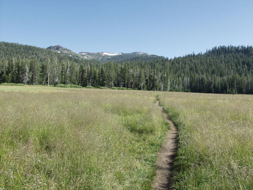
January - Cache Creek Ridge Backpacking

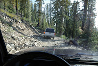
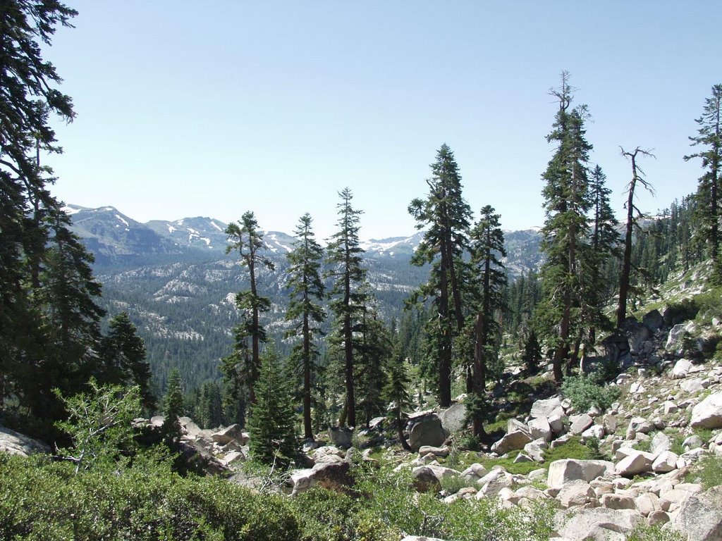
One of the nice things about living in California, is that you can go hiking year around. I usually hike near my home in the inter coastal in the fall/winter/spring until the weather gets too hot to enjoy hiking. this time I decided to take a backpacking trip cache creek ridge. the weather was nice and it was supposed to be in the 40-50s during the day for the week.

I started my hike at brophy canyon, hiking cross country up the ridge and connecting with one of the ranch roads (name) in the area. I followed the trail and turned south at ??? trail pasing the old stage coach stop and meeting up with the cache creek ridge trail, heading west. most of these trails are on BLM public land and this time of year the land is populated by bovine, which I'm sure are pretty weirded out having people hiking through their pastures. I hiked until sunset and pitched camp at the side of the trail in part of the trail that is not racnhed.

On this hike I was trying out my new backpack which I bought on sale and want to use on a thru hike this summer. I packed a stove, fuel, sleeping bag (30F) and pad, plus enough water (1.5Gal) and food for an overnight trip. no tent, since I wasn't expecting rain or high winds. for dinner I had oatmeal wit brown sugar which is great for cool days. the night started out nice with clear skies. watched the stars and various jets taking off from SMF heading west and north. around 0100 it became obvious that the 30F sleeping bag I had wasn't going to be warm enough. my legs were cold... struggled with trying to find a position that would be more comfortable/warmer until I remembered my space blanked in my emergency kit. wrapped it around my legs and now I was warm. in the morning, I awoke and noticed that the sleeping bag had frost out the outside. so, the temps were defintately below freeezing and space blankets do a good job of insulating, except that they are noisy (crinkly...) and contain the moisture. anyway, made some more oatmeal and had hot tea, both with brown sugar and got underway.

I kept hiking west until I hit a 4 way in the trail. the BLM trail marker was torn down, so I wasn't sure which of the 2 likely branches SW or NW I should take. I took the SW branch and followed it until it started peterging out for about 45mins. backtracked and followed the NW branch, until another branch further down the trail. I followed the spur to the parking area on HWY20, and then turned around retracing my route until the T on cache creek ridge trail were I started the day before. this time, I followed the ridge all the way to the eastern end, which is on bear creek, near the confluence of bear/cache creek.
a short trip 1+miles along HWY16 north back to were I left the car.

Notes for this hike :
- oatmeal is tasty with brown sugar, especially in colder weather
- my new backpack is one of the most comfortable packs I have worn (old style REI UL60 long)
- need long underwear for sleeping in 30F sleeping back around 30F
- need to do something about my toes hurting on long hikes. the total trip for both days was around 25miles

Febuary - Cold Canyon in the Rain

My wife's friend was in town and we had made plans to go hiking. since the forecast called for rain the girls decided not to go hiking and hang out watching movies at home instead. can't blame them, but since I was in a hiking mood, I decided to go for a short hike anyway at cold canyon. about 1/4 into the hike is started raining and I was soaked in no time... oh well, I'm wet now, might as well finish. despite the rain, the hike was nice until I got the end of the trail (I went clockwise) where they had build a serpentine trail, since the old trail went straight up the side of the ridge and was eroding. by now it had stopped raining. the new trail was done very nicely, but unfortunately since all of the earth work was fresh, it was very muddy, which made it hard to descent down the ridge. I met some hike coming up the ridge at 4:00, who seemed ill prepared, wearing tennis shoes and just starting out. sunset was still early, so they'd probably have to come down near dark. oh well, live and learn.

February - Fiske Creek / Rayhouse Road loop

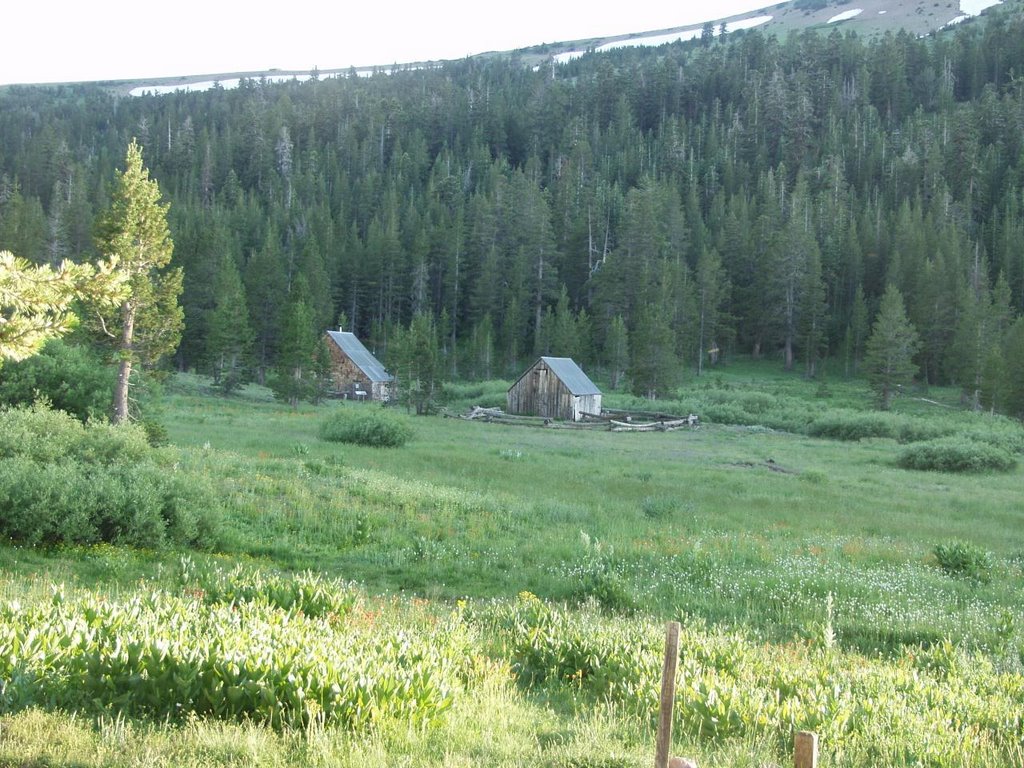
I hiked fiske peak a couple of time last year and though it might we fun to explore the area. I picked the fiske creek trail, which runs parallel in a canyon to blue ridge. you have to take ray house road to get to the trail head, which is about 2.5 miles from the beginning of the road and parking area. normally, ray house road is open in the summer, but it's busy with rafting traffic of buses taking rafters to drop off points near bear island on the cache creek. fisk creek trail runs 4 miles south until it intersects fiske creek road. fiske road then follows up the opposite ridge until it intersects ray house road at the 4 way intersection.

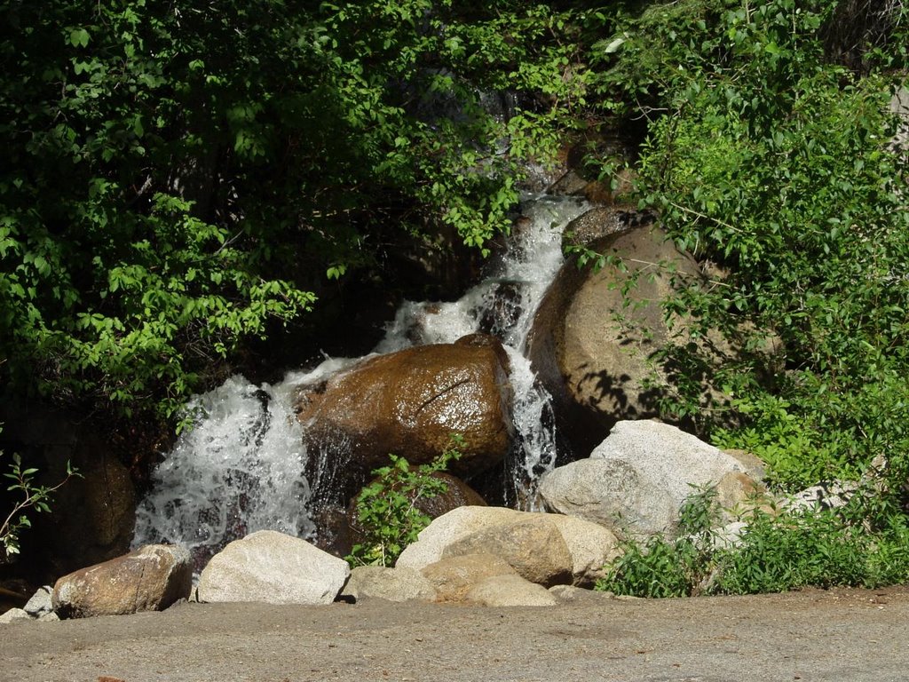
since there was going to be plenty of water, I took dakota the ueber dog with me. she is a lot of fun and loves to hike, when there is enough water to cool off in and drink. the hike from the parking area to the trail head is a bit uneventful. once on fiske trail, which is at about 1600ft ele. the trail descents into the canyon, which is probably around 700-800ft.. the tail follows an old ranch road and crossess the creek several times, which was flowing well from the rains of last week. the canyon bottom was pleasent with oak groves and pastures in wide places. at the other trail head (fiske creek road) I was welcomed by a bunch of trash. bummer... wish the road was open and I would go down with my trooper to haul it away... we'll have to wait.

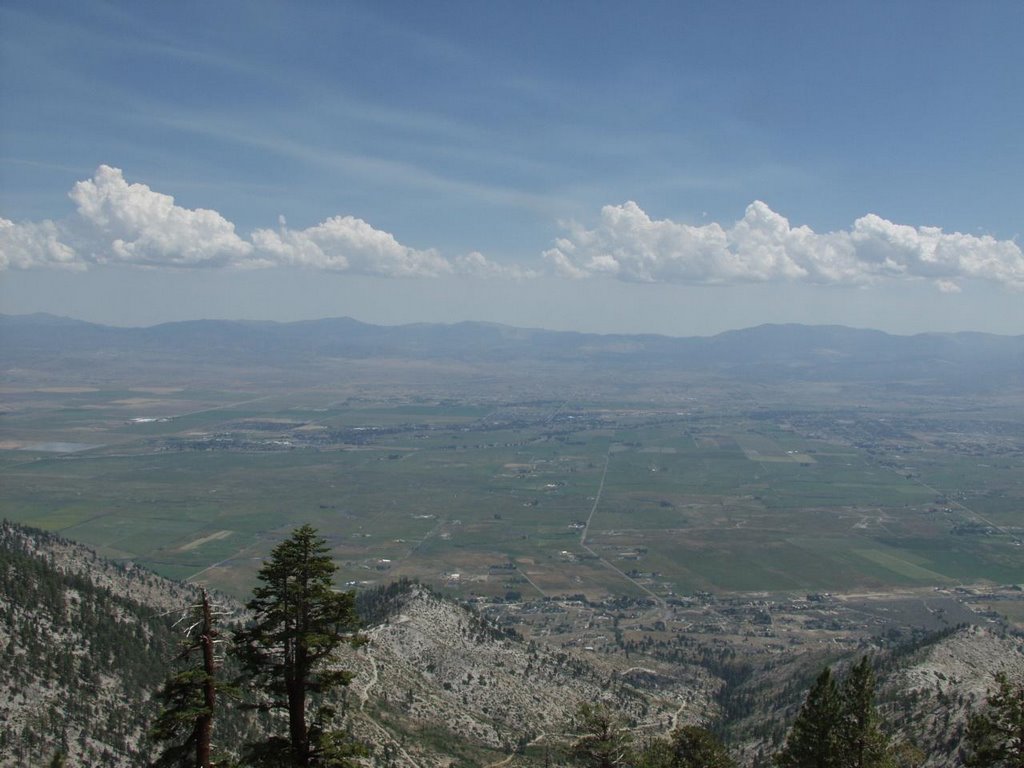
took a break and prepared for the long hike up to ray house road, which is at about 2500ft. the hike up the ridge was long, but the scenery on top of the ridge was very nice. there was a pond to stop and dakota tanked up on some water. once I got to the four way intersection (four corners), we starting back down ray house road. met some guy going down the road on a motorcycle. we kept going past the two trail heads to fiske creek trail (didn't know there were two), and end up in the parking area... this hike was about 2.5+4+5+??+3.5 miles... probably 17-18 miles total. I was trying some new socks with more padding, but my toes still hurt a lot, mostly from going down hill.

Arpil - Blue Ridge / Fisk Creek loop

haven't had enough from the first loop adventure and decided it would be fun to do the other loop. this one consts of going up blue ridge trail, past fiske peak and lowry peak, descending... into fiske creek and back via ray house road. last weekend was a nice day for hiking and even managed to get a little sunburned. I decided to make this a backpack trip for more conditioning and since I was unsure whether I would be able to finish before dark or not.

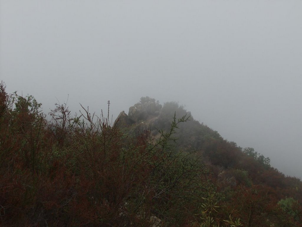
ascending to fisk peak was grueling. I had hiked up this way a couple of times in the last 3 mos, but didn't remember it being this hard in the past. then it dawned on me that hiking up 15% inclines (in places) with a 40+lbs pack isn't the same as without backpack. the new backback is pretty comfortable, that I forget I'm waring it. except for the reduce climbing performance... once I established that, settled on more resting climbing pace and finally made the peak in 2.5hrs... took a rest and signed the register. trying to continue on what I thought was the blue ridge trail ended up in the middle of burned brush from the rumsey fire. after beating through the brush, I finally found the real "trail" after being covered with black soot. the trail is not very well defined after fiske peak, also I didn't notice any foot prints, so I think it's been a while since anyone has hiked this section. Rumsey canyon was a challenge going south on the trail with steep climbout back up to lowry peak, but it's a great opportunity to practice my climbing pace. there was a lot of haze so the visibility wasn't that great, but the haze was burning off during the afternoon and it was improving... past lowry peak and to the end of the "maintained" part of the blue ridge trail.

here we descend on a mountain goat trail for about 0.5miles along the side of the ridge down to the parking lot area of fiske creek road (closed). this trail is very narrow and luckily there were no washouts or obstructions. the parking lot looks alien on the side of the ridge. it's perfectly flat and has a sheen of green grass on it this time of year. there are no visible vehicle tracks or foot prints. it looks like noone has been there for quite some time. going down fiske creek road, I pickup some motorcycle tracks. there were also some washouts in the road, which would have made it impossible for any regular cars to make it to the parking lot areas. the trail head for the fiske creek trail was still littered; have to remember to organize a trip sometime to pickup trash once the road is open again this summer.

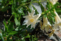
this time, I'm hiking fiske creek trail back the opposite direction. the canyon is still very nice. I notice more wildflowers in the area this time, then last time (a month ago). the creek is pretty low and not flowing in some place. all of the side creeks are dry. at the final creek crossing, the creek was flowing better and the water looked clear and fresh and was cool. I filled up one of my bottles and added water treatment, since I was running low on water I brought with me.

climbing back out the canyon was very steep... funny I didn't remember how steep this section of the trail was, since I went down it the last time... it seemed to go on forever, but finally made it to the ray house rd. trailhead. hiked back down rayhouse road to the parking area... not bad for a days worth of hiking. (8.5+2.5+4.0+2.5 = 17.5 miles and about 4000ft elev. changes all together...

Sunday, September 10, 2006

Cold Canyon

this weekend I went for a short hike at Cold Canyon. Cold Canyon is the closest place to go hiking from where I live and I go there about once a month or so, if it's not too hot. Unfortunately, part of the trail is off-limits to dogs. There is a 5+miles loop there which is surprisingly rugged/streneous in parts (rocks/bolders and1000ft elev gain in 1mi, etc.). It's great for conditioning and breaking in gear. This time, the top of the ridge was socked in with low lying clouds/fog, which didn't burn off until later that morning.

Ascending the ridge looking down the putah creek.


A little higher at the cloud layer looking through the gap towards the central valley.


Peak shrouded in fog/clouds.


Another foggy peak.


The colors actually show up really well with the diffuse light.

Sunday, September 03, 2006

Star Lake

earlier last month I hiked a segment of the tahoe rim trail with dakota from kingsbury grade to star lake and back. star lake is a alpine lake on the carson ridge at about 9000ft, right below freel peak.

The view down into carson valley.


Dakota waiting for me on the trail.


Me chugging up the ridge.


Ah, the destination... went for a dip. it was "cold", polar bear club anyone...


looking towards freel peak from monument pass, I think.
Barker Pass to Tahoe City

this weekend I went on another segment of the tahoe rim trail. barker pass is a trail head between echo lakes 32miles) and tahoe city (16miles). around 7:00a dak and I were ready to go head out.

after a couple of false starts (forgot dak's leash, then my watch), we finally hit the road up to tahoe. my car's tranmission has been shifting a little rough all summer and was acting up on the way up, but my trusty navigator was helping me find the way, while I struggled with shifting going up the hills.

by the time I got the trail head, it was making funny noises... well, I was there and since the trail head is pretty much out in the middle of nowwhere, so might as well go hiking. about 9:45a we hit the trail.


here is a photo looking back at barker pass as we start heading up.

here is a shot of lake tahoe on the way up... still foggy.


granite outcroppings along the ridge, from both sides.


dakota relaxing in ward creek.


last view of granite peaks before we start descending into tahoe city.


traveling through page meadow...


some random shots from the trail.... the tree eating the rock, a pretty flower, and the obligatory self potrait.


jessica picked me up at the tahoe city trail head and we went back to get my car. at first my car would not go into reverse, once it did, everything was sort of ok. it was still shifting kind of rough and there were noises, but it was going. by the time I got home, things were not so good. now the transmission sounds like it has loose parts inside (which it might)...

I had a big bad blister on my toe. I haven't had a blister for years, so that was kind of novel. I was breaking in a new pair of boots on this trip. anyway, here is a picture of the blister...


kids don't let this happen to you !

Wednesday, August 02, 2006

last week we had our night photography "lab". I was able to get some nice photos of the arboretum and surrounding area.
this is an image of the dark area exposed for as long as possible wide open and with the film sensitivy setting set to 320 ASA. if I wanted to longer exposures I would have to use the "bulb" setting, but I don't have a remote shutter release for my camera. I like how the sky and water is lit up almost as if it was daytime, but yet there is the glow from the street lamps that illuminates the grass and trees/bushes.

I thought this was a cool shot/angle, although the handrail detracts a little from the image. they probably would not have been all too happy, if I removed the handrail for this shot... honestly, officer, I was going to put it back, right after I get done.


in these next two shots, I was playing with the white balance of the camera. this first shot is set on "auto". this is where the camera looks at the pictures and figure out how much it has to "shift" the color balance to make it "normal". of course, "normal" is a little subjective with these night photos.


this shot is taken with "manual" white balance set to 5500K. I think the grass looks nice in this.


this is another long exposure shot. to give you and idea of how dark these areas are, you sort of make out the park bench, but not that there were people sitting in it.


finally, we had a nice "clear sky" day the other day and I stopped along the highway to take some sunset photos with these cool clouds. these shots were all taken free hand without tripod.


tonight, we are going to get together and critique our work with the people in the class and the instructor. I'm looking forward to seeing the results of my classmates. everyone shot with film camera and had the film processed and printed at a one hour lab. I took my digital images on a flash disk to a couple of one hour places and had them printed. actually. one machine decided to "enhance" my photos and color balance as well as adjust the exposure on them, nullifying all of the manual settings. all of the bracketted shots ended up looking the same, also I didn't like how the grass/leave green was enhanced. too bad there isn't a way to turn that off. it will be interesting how the processing machine delt with the film images. this class is a really fun/neat experience.

Sunday, July 30, 2006

Big Meadows to Echo Lakes

this weekend I went backpacking at lake tahoe. I went on a section of the tahoe rim trail from big meadow to echo lakes, and then part of an old pony express trail back to the trailhead making it about a 25mile loop. the weather was gorgeous and the scenery awesome.

the hike starts off as an easy stroll through the same meadow from last weekend, but splits off a mile into it.


one of several alpine lakes, round lake, on the trail.


this scene made me hear "heidi, heidi" in my head for the next few miles.... as I trudge through the south truckee river valley.


another alpine lake. I camped at this lake, showers lake, at about 8300ft. this is the view from where I woke up.


icefields in july ? yes, at about 9000ft elevation. there were several icefields some of which were still across the trail. thsi section of the trail pretty much just opened up the last week or so.


random scenic view as I was coming down from the ridge/mountain on my way to echo summit.


a much apreciated refreshing water fall/stream toward the end of the hike on part of the poney express trail.


over all it was a really nice trip, but by the end my legs turned to butter from all of the elevation changes with the backpack (7300 -> 8300 -> 9000 -> 7300 -> 8000 > 7500 -> 8000 -> 7500 -> 6000 -> 7300 ft) most of it in one day.